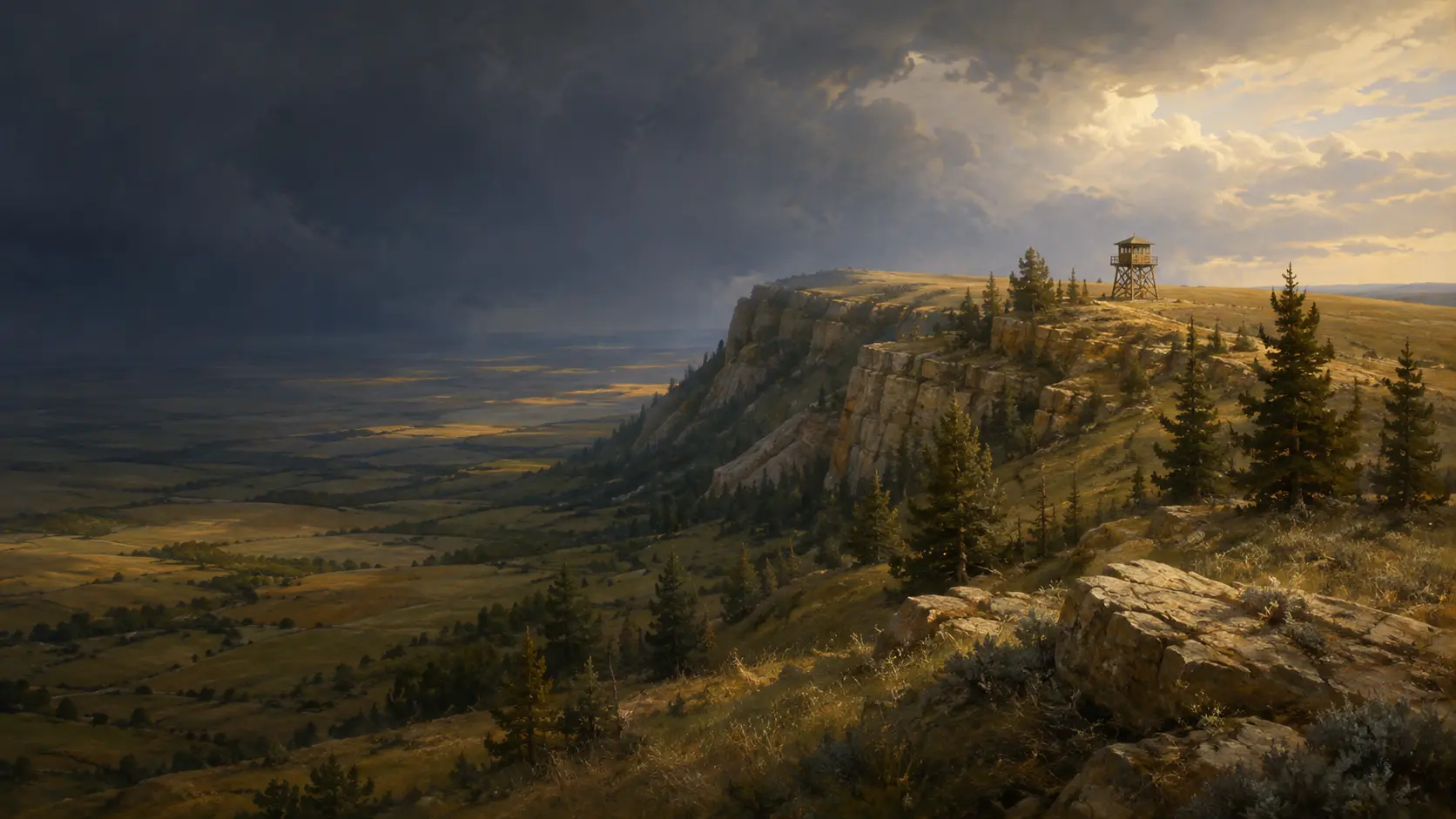
Cypress Hills Interprovincial Park · Alberta & Saskatchewan
Where the
prairie rises.
Climb from open grassland into a cool lodgepole pine forest and discover how one high plateau can change weather, habitat, and the view.
PLACECypress Hills
LANDFORMErosional plateau
ECOSYSTEMPrairie–forest mosaic
BIG IDEAElevation changes habitat
Read the high ground
A plateau can rewrite the landscape around it.
The Cypress Hills rise sharply from the plains on the Alberta–Saskatchewan border. The high ground was shaped by deposition and erosion rather than mountain folding, and its elevation creates a striking meeting place for fescue grassland, lodgepole pine, white spruce, aspen, springs, ravines, and exposed viewpoints.
 MAP · LAYER · CHECK CONDITIONS
Field habits for adults
Prepare for two landscapes—and fast-changing weather.
The same route can move from exposed prairie sun into cooler forest shade and ridge-top wind. Treat the park overview as orientation, then use the current map for your chosen block.
- 01
Carry layersTemperature, wind, cloud, and precipitation can differ between the plains and the plateau.
- 02
Use the correct park authorityAlberta and Saskatchewan publish separate advisories, services, fire information, and detailed maps.
- 03
Report; do not investigateIf you see possible smoke, stay safe and contact park staff or emergency services rather than approaching it.
Access, closures, fire restrictions, weather, road conditions, operating dates, and services can change. Confirm them with the appropriate park authority before visiting.
A ridge with its own rules
Four forces create the Cypress Hills contrast
The story compresses a real set of relationships: landform influences local weather, weather shapes vegetation, and high viewpoints support observation.
Protected plateau
A hard conglomerate cap resisted erosion while the surrounding plains were lowered.
Elevation & weather
Higher ground alters temperature, wind exposure, cloud, snow, and available moisture.
Forest islands
Lodgepole pine, white spruce, and aspen form communities unusual on the surrounding prairie.
Long sightlines
Ridge-top lookouts turn elevation into an early-observation advantage.
From grass to forest
Elevation creates a new set of growing conditions.
Rising more than 600 metres above the surrounding prairie, the Cypress Hills intercept weather and create cooler, moister niches. The result is not a simple line on the slope, but a shifting mosaic shaped by aspect, exposure, soil, fire history, and drainage.
- RiseThe plateau lifts the landscape into cooler air and stronger exposure.
- CatchCloud, rain, snow, and runoff interact differently with the high ground.
- ShelterNorth-facing slopes, springs, ravines, and creek bottoms retain more moisture.
- ChangeGrassland, pine, spruce, and aspen occupy different parts of the resulting mosaic.

A prairie forest outpost
Lodgepole pine tells the elevation story.
Alberta Parks identifies lodgepole pine as the predominant Cypress Hills forest. Dense stands create deep shade, while solitary trees on open plateau grassland grow fuller crowns where light reaches from every direction.

Elevations above the plains.
Rain, snow, shade, and springs.
Pine, spruce, aspen, and openings.
A green island in grassland.

Observation becomes infrastructure
A fire lookout turns height
into an early warning.
A lookout cab is raised above nearby trees and opened to broad sightlines. Trained observers use landmarks, bearings, maps, and communications to report possible smoke so wildfire professionals can evaluate it.
Good observation ends with a clear report—not a closer look.
Today, towers can work alongside aircraft, satellite monitoring, cameras, lightning data, and public reporting. The chapter’s safety lesson remains durable: notice, communicate, and leave investigation to trained crews.
A closer reading of the chapter
Four field notes for the adult explorer.
The supplied journals are not reproduced here. Their core ideas are reframed as concise, research-backed context for route planning, climate, botany, and public safety.
Maple Creek → Centre Block
Start by naming the block.
The story’s Lookout Point and prairie-to-forest climb align with the Saskatchewan Centre Block. The West Block and Alberta side are separate destinations with different access.
Elevation + exposure → change
Higher does not mean one fixed forecast.
Elevation generally cools the setting, but slope direction, wind, cloud, forest cover, and time of day all matter. Pack for variation rather than a single number.
Light + moisture → forest form
Read the shape of the trees.
Dense lodgepole pine stands produce straight trunks and heavy shade. Open-grown pines spread wider crowns, while white spruce favours cooler moist ground.
Observe → locate → report
Possible smoke is information, not an invitation.
Use landmarks and direction to make a clear report. Do not leave a safe route to investigate, and always follow current park instructions and fire restrictions.
Find the chapter landscape
One interprovincial park, several distinct travel areas.
The chapter’s Lookout Point route aligns with the Saskatchewan Centre Block south of Maple Creek. Cypress Hills also includes a Saskatchewan West Block and extensive Alberta parkland near Elkwater, so choosing the correct block before travelling matters.

The Saskatchewan Centre Block is about 27 km south of Maple Creek on Highway 21.
Lookout Point and Bald Butte are nearby Centre Block destinations reached from the park’s core area.
Centre Block, West Block, and the Alberta side have separate access routes, services, and conditions.
 Read the full chapterOpen Story 2 ↗
Continue the Prairie Adventure
Story 2
A Mountain Above the Prairie
Join Lumi, Aspen, Hazel, and Barrett as a climb from warm grassland into cool forest reveals a fire lookout, a drifting thread of smoke, and the safest way to turn observation into action.
Opens the chapter page on the main Maple Explorers site.
Questions from curious explorers
High-country notes, answered.
01Where is Cypress Hills Interprovincial Park?+
Cypress Hills spans the Alberta–Saskatchewan border. Its Alberta parkland, Saskatchewan West Block, and Saskatchewan Centre Block are distinct travel areas connected by public roads rather than one continuous park road.
02Why is it called a mountain above the prairie?+
The Cypress Hills are an erosional plateau that rises more than 600 metres above the surrounding plains. A resistant conglomerate cap helped the high ground remain while erosion lowered the land around it.
03Why is the climate different on the plateau?+
Elevation changes temperature, wind exposure, cloud formation, snow, and moisture. Aspect, shelter, forest cover, and drainage add local variation.
04What trees grow in Cypress Hills?+
Lodgepole pine dominates much of the higher, drier forest. White spruce favours cooler moist sites, while aspen and balsam poplar occur in mixed stands and lower or wetter areas.
05How do fire lookout towers work?+
A high position and windows in several directions give trained observers a broad view. Maps, bearings, communications, aircraft, satellites, and public reports can all support early detection.
06What should I check before visiting?+
Check the appropriate Alberta or Saskatchewan park authority for current access, advisories, fire restrictions, weather, road conditions, operating dates, and services. Use the latest official map for your chosen block.
Research trail
Official sources behind the field guide
Geography, geology, vegetation, wildfire observation, and route guidance were checked against provincial and federal sources. Confirm current conditions directly with the appropriate park authority before travel.